

The city quarter, Middelfart
The strategy consists of utilizing the natural slope of the terrain to divert rainwater to the Little Belt. Around Adlerhusvej, as many homes as possible are sought, disconnected from everyday rain, so that the rainwater is handled locally. It is voluntary, and you get the connection fee back as well as permission to overflow onto the road. It is everyday rain that must be handled on the grounds (T=2, corresponding to approx. 5 annual overflows).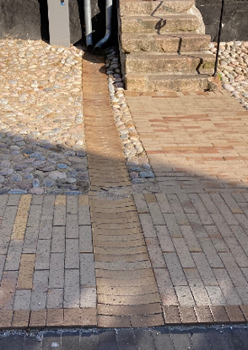
Figure: The roof water is led in gutters over the pavement to the road
The streets in the historic city center are generally narrow, and therefore the rainwater here must be handled in the road itself rather than rainbeds. The roofs of the houses facing the street are disconnected from the sewers and the rainwater from here is led directly to the road via gutters.
In the Bykvarteret, a simple trough shape is established in the middle of Adlerhusvej, Skovgade, Knorregade, Smedegade and Brogade, so that the rainwater can be directed onto the road. The trough shape will be deep enough so that the rainwater, even in a cloudburst situation, can be directed down to the harbor and further out into the Little Belt. The roads are made of asphalt. Apart from Brogade, which was made with cobblestones for historical reasons.
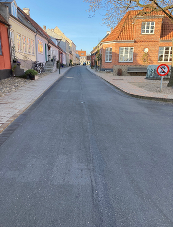
Figure: The road profile is trough-shaped made of asphalt
At Havnepladsen, the rainwater is directed directly to a large sand trap and an oil separator before it is discharged into the Little Belt. In the event of extreme rain, the rainwater is directed directly to the Little Belt. The area with the tiled wall can be used for living.
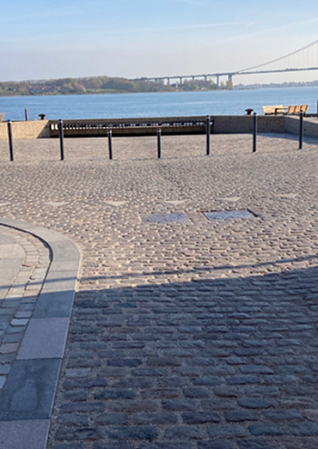
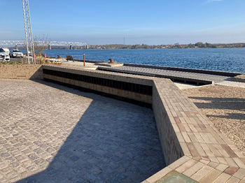
Figure: The harbor area with an outlet to the Little Belt, and with the possibility of staying at the facility
Read more here: