

Climate adaptation plans
All local authorities are required to prepare climate adaptation plans, and the Danish Nature Agency has provided various tools for local authorities for this purpose. All the information is available at www.klimatilpasning.dk and here (in Danish).
Copenhagen
The City of Copenhagen’s climate adaptation plan (in Danish): Copenhagen's climate adaption plan
Action plans, etc, for Copenhagen’s climate adaptation: http://www.kk.dk/Klima.aspx
The Information Centre on Climate Change Adaptation has designed a new screening tool to show which areas will be affected by rising sea water levels. Enter the expected water level and see which local areas will be flooded. You can see the new tool here (in Danish).
These areas will be hit hardest by flooding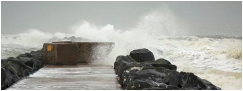
Ten areas in Denmark will be severely affected by flooding if exposed to extreme storm surges or intense rain – also known as once–in–a–century events. Attempts are therefore now to be made to examine how best to protect these 10 coastal areas from water damage in future.
These findings appear in a report published by the Danish Nature Agency and the Danish Coastal Authority that identifies areas in Denmark at risk of flooding from streams, lakes, the sea and fjords in extreme cases. The areas have been identified as part of the follow-up work on the EU floods directive adopted after severe flooding in Central Europe.
The 10 Danish risk areas are: Holstebro, Randers Fjord, Juelsminde, Vejle, Fredericia, Aabenraa, Odense Fjord, Køge Bugt, Korsør and Nakskov.
The city of Greve also have a climate adaption plan, see here.